A 1961 map of Tikal shows a small hill between two elite house groups. The mappers drew it with natural contour lines. In their field notes they also recorded blocks of masonry on its surface.
In 2016 a laser survey crossed the same ground. It showed an eastern pyramid, an enclosed plaza and flanking platforms. The authors who studied it now read the hill as a smaller copy of a citadel in Mexico.
The traditional view
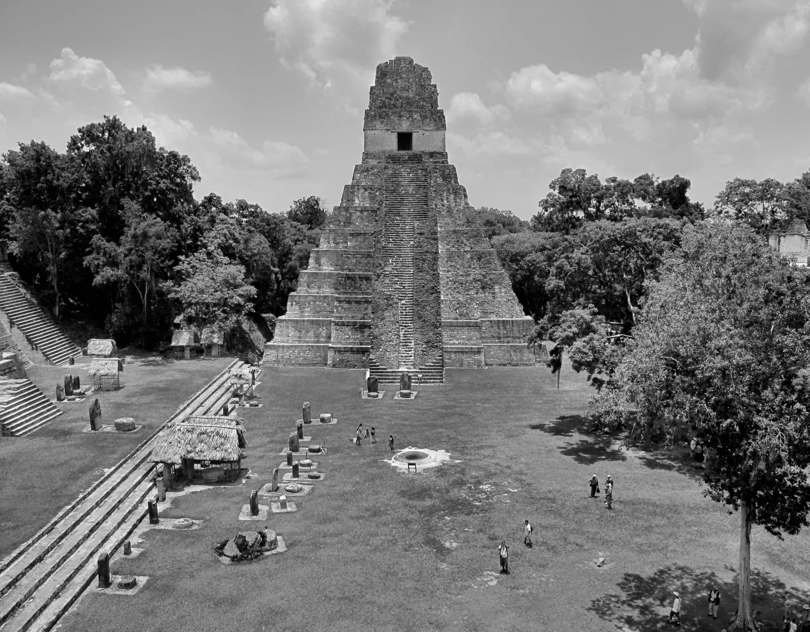
UNESCO describes Tikal National Park in Guatemala as holding "thousands of architectural and artistic remains of the Mayan civilization from the Preclassic Period (600 BC) to the decline and eventual collapse of the urban centre around 900 AD." An inner urban zone of around 400 hectares holds the main monuments. A wider zone of around 1,200 hectares covers "residential areas and historic water reservoirs, today known as 'aguadas'."
The carved monuments give the city a dynastic record. UNESCO says the earliest stone sculpture is Stela 29, dated to the year 292, and the last is Stela 11, dated to the year 869. It says the records register the lives of 33 rulers.
The University of Pennsylvania worked at Tikal for years. The Penn Museum describes William Coe's Tikal Report 14 as "integral and pivotal to the entire Tikal publications series." That report covers the Great Plaza, North Terrace and North Acropolis. UNESCO adds a caution. It says earlier restoration projects "eroded to a certain degree the authenticity of the remains."
The size of the city has been revised more than once. William Haviland published a preliminary estimate of 10,000 to 11,000 people in 1965. His 1969 paper replaced it with "conservatively, 49,000 persons" for the Late Classic city. A Smithsonian Magazine feature says Tikal held "at least 60,000 Maya" around A.D. 750. It also says the ruins visible today "represent but a fraction of the original city-state." I have not checked how that magazine reached its figure.
The Maya themselves are still here. The Smithsonian National Museum of the American Indian says Maya people "are active participants in the social fabric of an international world." It also says rituals and ceremonies connected to the land and the calendar "are still practiced today."
What the Evidence Does Not Settle
The book does touch three ideas that meet this city. In Chapter 5 I write that history books treat the ancient world as a series of isolated experiments, and I list Maya pyramids among my examples. In Chapter 18 I write that LiDAR "digitally strips away the canopy" and shows an interconnected Maya civilization. I also write that the new Maya population estimates "are now mainstream."
In Chapter 16 I write that fewer than 20 of an estimated 400 Mesoamerican codices survive, and that Bishop Diego de Landa burned Mayan books in 1562. Tikal's inscriptions are carved in stone. The next three questions stay with those inscriptions and with the ground around them. They sit beside the Teotihuacan article, which looks at the other end of the 378 story.
Three Questions the Ground Leaves Open
Who arrived in 378?
David Stuart, an epigrapher then at the Peabody Museum, opens his essay The Arrival of Strangers by naming a polarized debate. One side posits "an overt and disruptive Teotihuacan presence in the Maya lowlands in the late fourth century A.D., associated with military incursions if not political domination." The other suggests the Teotihuacan styles and objects "might better be seen as a local appropriation of prestigious or legitimating symbolism and its associated militaristic ideology."
Stuart reads Stela 31 for a date written as 11 Eb, which he equates with January 16, 378. He reports that the same stela appears to say the Tikal king Jaguar Paw died on the day Siyah K'ak' arrived. He writes that "it should be cautioned that the language of these texts is seldom so explicit." He concludes there is "no choice" but to see Siyah K'ak' as a foreigner, and he is willing to "speculate" that he led a military force.
The ground adds a second line of evidence. Houston and colleagues report that the Tikal precinct is about 30 percent smaller than its model. They write that the wider sector is "oriented 15.5±1° to the east, resembling the grid that guided the urban plan at Teotihuacan." Excavation found Teotihuacan-style incense burners and green obsidian points. In the book I give the Avenue of the Dead as 15.5 degrees east of true north.
The authors write that the precinct "appears to be a plan-within-a-plan: a deliberate evocation of a focal feature of Teotihuacan." They also write that finding "unambiguous proof of 'hard' or 'soft' contact remains a challenge." Did an army arrive, or did Tikal copy a distant imperial city on its own terms?
What did 130 years of silence mean?
The Smithsonian feature says "of all the dated stelae found at Tikal, not one is from between a.d. 562 and 692." It calls this "monumental silence" the Hiatus. Caracol, a city in Belize, recorded a "star-war" against Tikal in 562 on its Altar 21. Arlen and Diane Chase list the results at Tikal. They name "a dynastic upheaval accompanied by monument destruction, the cessation of monument erections for 130 years in the site epicenter, and a decrease in the population of outlying residential settlement."
The Chases point to a dissent elsewhere in the same article. Hattula Moholy-Nagy published a study that weighs architecture, settlement patterns, caches, burials and domestic artifacts alongside the inscriptions. She concludes that "Tikal's long hiatus can be regarded as part of a sequence of internal political development rather than due to conquest from outside."
Her 2016 paper goes further. She writes that "archaeological evidence from the Lowland Maya city of Tikal contradicts the assumption of general decline during its longest hiatus, as well as a widely accepted historical explanation of its cause." She argues the gaps were more likely due to monument desecration by rival elite factions than to specific historical events.
Both sides read the same silence. One reads a defeat written by the winner. The other reads a pattern in the ground. Which record should settle what happened to Tikal?
What was the water system for?
Kenneth Tankersley and colleagues report the oldest known zeolite water filtration system in the sediments of the Corriental reservoir. They write that between about 2185 and 965 calendar years before present the drinking water "was filtered through a mixture of zeolite and coarse, sand-sized crystalline quartz." By my arithmetic that runs from about 235 BCE to 985 CE. They trace the minerals to a source about 30 kilometers northeast.
The uppermost layer containing zeolite dates to the Late Classic. They write that "the filtration system was not restored after this event." They add that "it is possible that the Maya no longer had access to the necessary raw materials," after first saying it is "impossible to know" why.
The great ditch and bank near Tikal has had its own reading. Silverstein and colleagues write that the earthworks "have long been understood as the most extensive example of defensive architecture in the Maya Lowlands." Their new survey suggests that the extent and course of the earthworks "are not consistent with the demarcation of the north and south limits of the polity." They offer a hypothetical model of a "limestone filtration trench" that could have collected subsurface water against drought.
David Lentz and colleagues write that how Tikal fed its population "has been a topic of unresolved debate among researchers for decades." They report a managed landscape at its "carrying capacity" that "ceased to provide adequate food, fuel, and drinking water" when rainfall dropped in the mid-9th century. They also write that the drought was "likely anthropogenically influenced."
A filter that lasted over a thousand years stopped being rebuilt. A ditch may have been a wall or a trench. What was the city's water system built to do, and what did the city lose when it stopped working?
The questions I can't put down
Some questions need more room than one article gives them. Two of them keep pulling me back.
How many people lived here? Haviland moved the estimate from about 10,000 to 49,000 in four years. The 2016 LiDAR survey reported in Science in 2018 covered 2,144 square kilometers of northern Guatemala. Its authors say it "compels a reevaluation of Maya demography, agriculture, and political economy." In the book I follow that survey and what it did to the old picture of scattered city states. I find that question in Earthly Enigmas.
What was the Lost World complex lined up with? Aimers and Rice date its first building episode to about 700 to 600 BC. They also write that E-group alignments "were rarely accurate." In Chapter 5 I set out alignments across cultures and I report that one scholar says some of those arguments exaggerate accuracy. You can read a free sample of the book before you decide. The Uxmal and Calakmul articles look at two other Maya sites in the same format. The articles section has more subjects.
Sources
- UNESCO World Heritage Centre: Tikal National Park
- Penn Museum: Tikal Report 14, Great Plaza, North Terrace and North Acropolis
- Haviland, A New Population Estimate for Tikal, Guatemala (American Antiquity, 1969), abstract
- Smithsonian Magazine: Secrets of the Maya, Deciphering Tikal
- Smithsonian National Museum of the American Indian: The Maya People
- Houston and colleagues, A Teotihuacan complex at the Classic Maya city of Tikal (Antiquity, 2021)
- David Stuart, The Arrival of Strangers (Mesoweb)
- Chase and Chase, Caracol, Belize, and Changing Perceptions of Ancient Maya Society (2016)
- Moholy-Nagy, The Hiatus at Tikal, Guatemala (Ancient Mesoamerica, 2003), abstract
- Moholy-Nagy, Set in Stone: Hiatuses and Dynastic Politics at Tikal (Ancient Mesoamerica, 2016), abstract
- Tankersley and colleagues, Zeolite water purification at Tikal (Scientific Reports, 2020)
- Silverstein and colleagues, Rethinking the Great Earthwork of Tikal (Ancient Mesoamerica, 2009), abstract
- Lentz and colleagues, Forests, fields, and the edge of sustainability at the ancient Maya city of Tikal (PNAS, 2014)
- Canuto and colleagues, Ancient lowland Maya complexity as revealed by airborne laser scanning of northern Guatemala (Science, 2018), abstract
- Aimers and Rice, Astronomy, Ritual, and the Interpretation of Maya E-Group Architectural Assemblages (Ancient Mesoamerica, 2006)