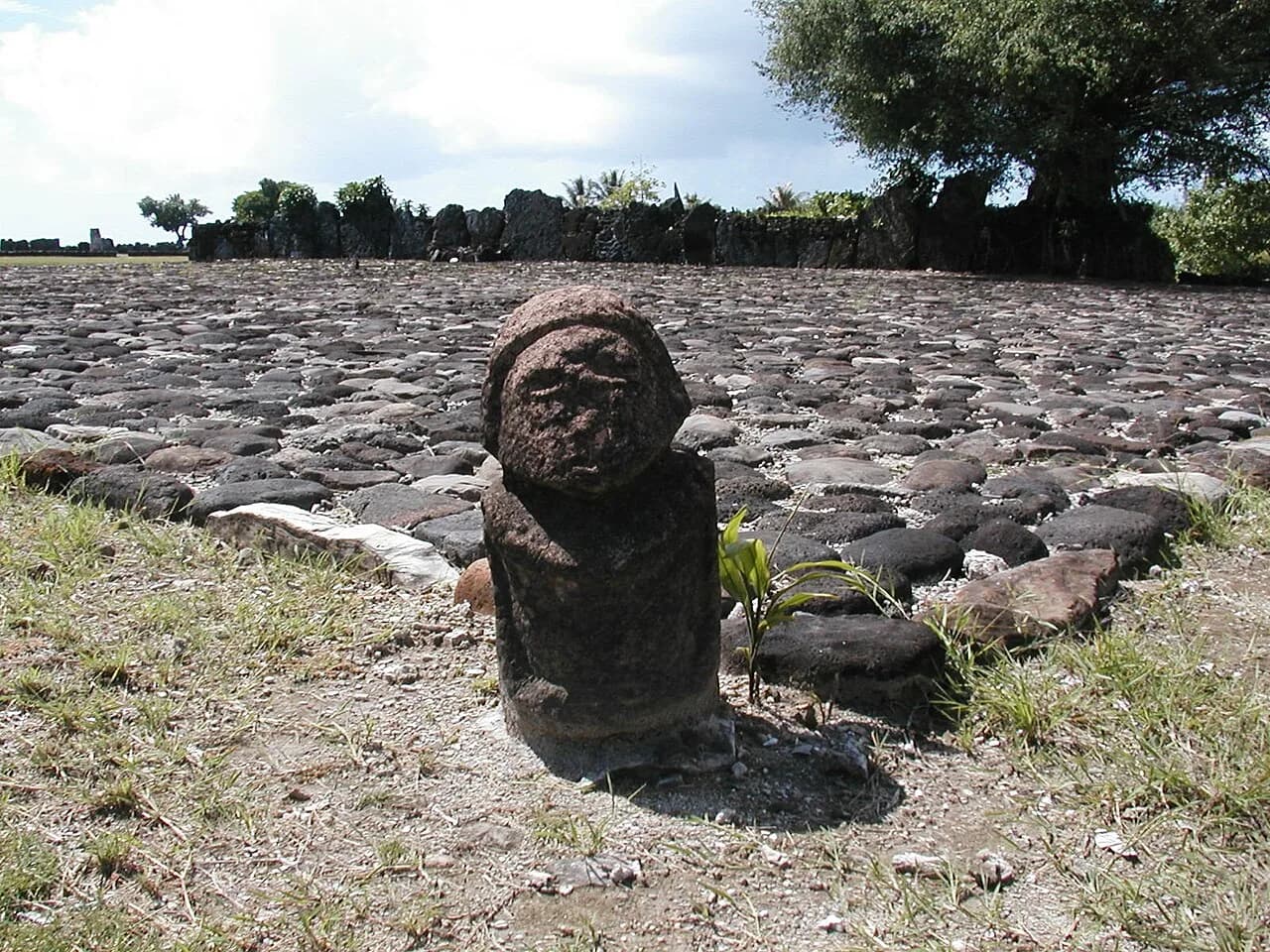
The courtyard at Taputapuātea on Ra'iātea measures 60 meters by 40. At one end stands a stone platform called an ahu. Its west face is 42.5 meters long and made of 23 upright slabs.
Two of the slabs are basalt. Earlier writers called the others limestone. A 2019 study by Bernard Salvat and colleagues found that they are microatolls, which are corals that grow in very shallow water.
The same study dated those corals and reports ages between 3 and 5 millennia. It places the building of the platform in the 17th and 18th centuries.
The traditional view
UNESCO added Taputapuātea to the World Heritage List in 2017. It describes a cultural landscape and seascape on Ra'iātea, an island at the center of the Polynesian Triangle. At the heart of the property is the marae complex, which UNESCO calls "a political, ceremonial, funerary and religious centre."
UNESCO writes that Taputapuātea was the center of a political alliance "that brought together two widespread regions encompassing most of Polynesia." Chiefs, warriors and priests from the other islands came to meet there. UNESCO adds that outrigger canoe building and ocean navigation were "key skills in maintaining this network."
UNESCO gives the site two ages. Its short description calls Taputapuātea "an exceptional testimony to 1,000 years of mā'ohi civilization." Its criterion on architecture speaks of temples built by the Mā'ohi people "from the 14th to the 18th century." It also says that stones were carried to other islands "to found other marae with the same name."
UNESCO reports a convergence "between the oral knowledge and documentary sources based on testimonies left by early explorers and missionaries." It describes Taputapuātea as "the ancestral homeland of Polynesian culture" and says some marae at the complex have been restored. According to UNESCO the layout and "most of the materials themselves are original."
The archaeology adds a more detailed picture. Salvat and colleagues write that the period of first construction "is not known precisely." Kenneth Emory and Yoshihiko Sinoto test-excavated the complex in 1962 and 1963. Restorations followed in 1968 and in 1994 and 1995.
Paul Wallin and Helene Martinsson-Wallin re-examined radiocarbon dates from ritual sites across East Polynesia and published the results in Antiquity in 2025. They report rapid change in the large stone structures of the Society Islands between about 1600 and 1765. They name Taputapuātea as the major marae of that kind.
Janet Wilmshurst and colleagues dated the first settlement of the Society Islands to about AD 1025 to 1120. They found that the remote islands of East Polynesia were settled in one major pulse soon after.
The Ocean Network
In Earthly Enigmas I write that history books treat the ancient world as a series of isolated experiments. In Chapter 5 I argue that precision stonework, sky alignments and sacred proportions recur in cultures with no documented contact. I write that building such a network took knowledge of latitude, longitude and ocean navigation.
In Chapter 3 I describe two other Pacific stone sites, Nan Madol and Rapa Nui's moai and ahu. I also place Easter Island among the 17 sites on Jim Alison's great circle.
Taputapuātea sits in the same ocean. UNESCO describes an alliance of islands held together by regular gatherings at this one marae.
Where the Sources Part Ways
The sources agree on a great deal. Three questions stay open.
How old are the standing stones?
Salvat and colleagues dated 38 samples from the platform with uranium and thorium. Their abstract reports that 19 microatolls "result in ages between 3 and 5 millennia." Their discussion gives a wider span of 1,498 to 6,255 years before present for the upright slabs, and most are more than two thousand years old.
The authors say these corals lived when the sea stood about 80 centimeters higher than today, "when the Polynesians had not yet arrived." Shells and the small filling blocks inside the platform date to the 17th and 18th centuries. The authors read this as the builders gathering fossil corals from the shore.
They offer a hypothesis that the builders collected the microatolls at the site "and that others are still underground." They also find it hard to admit that the reported custom of district people bringing their own stone applies to a coastal temple of this size.
The inner platform inside the visible one is a second open point. The authors write that its "real function remains unknown" and that it is now covered by fill. They say further work needs excavation of the platform during the next restoration, along with a test pit under the courtyard pavement.
Guillaume Molle and colleagues add a wider note. They write that sites such as Nan Madol and Polynesian marae use coral in their foundations. Discussions of the coral, in their words, "rarely detail the spiritual significance of choice and/or distribution of this material." I have read only the first pages of their article.
Where did the builders find the slabs, and what lies under the courtyard?
Which date belongs to Taputapuātea?
UNESCO's 1,000 years and its 14th to 18th centuries are two different spans. Salvat and colleagues place the visible ahu between the mid 17th and the 18th century. They also read the oral tradition of the marae as a place with several names and dedications. It was dedicated first to Ta'aroa and later to 'Oro, and from this they infer that it "had a long-time period and evolution."
Wallin and Martinsson-Wallin repeat the local legend that this was the first marae, built for 'Oro under Tamatoa I. They describe three stages across East Polynesia. Ritual spaces marked by stone uprights date from about AD 1000 to 1300 and formal ahu and marae from about 1300 to 1600. The large megalithic structures of the Society Islands come last, between about 1600 and 1765.
The Polynesian Voyaging Society's account of the marae begins with the words "Established around 1000 AD." Wilmshurst and colleagues date the first settlement of the Society Islands to about AD 1025 to 1120. I have not checked what evidence the Society relies on for its date.
How old is the place, and how old is the platform?
How did they find their way?
Wilmshurst and colleagues analyzed 1,434 radiocarbon dates. They conclude that the remote islands of East Polynesia, "from the tropic to sub-Antarctic oceans," were settled in one pulse between AD 1190 and 1293. They call it a "remarkably rapid and extensive dispersal."
UNESCO credits the voyagers with "navigation by observation of natural phenomena." The Polynesian Voyaging Society tells a related story. It says Hōkūle'a sailed to Tahiti in 1976 under Mau Piailug, a navigator from Satawal in Micronesia. The Society writes of that voyage, "There was no navigator from our culture left."
The same page says Nainoa Thompson sailed Hōkūle'a back from Tahiti to Hawai'i in 1980, "a feat that hadn’t been accomplished in 600 years." The Society says a conflict between two leaders broke the alliance and ended large-scale voyaging between the islands. Wallin and Martinsson-Wallin place the erosion of the interisland networks at about AD 1450.
Some earlier scholars argued that accidental drift played a large part in the settlement of the Pacific. A University of Hawai'i teaching volume says Ben Finney questioned Andrew Sharp's accidental-voyage argument. I have only seen that line in a search excerpt.
What did the voyagers know that let them cross the triangle and return, and how much survives?
The questions I can't put down
Some questions need more room than one article gives them. Two of them keep pulling me back.
Did the network reach the Americas? Alexander Ioannidis and colleagues report "conclusive evidence for prehistoric contact of Polynesian individuals with Native American individuals (around ad 1200)." Wallin and Martinsson-Wallin write that contact with South America "cannot be excluded" as an influence on the rise of hierarchy and large monuments on Rapa Nui. In the book I mention Thor Heyerdahl and the DNA result when I write about Easter Island. I follow the question through Earthly Enigmas.
Where does Taputapuātea sit against the great circle? Michael Rosola fitted a circle through 17 sites and puts Easter Island 9.62 kilometers from the line. His list holds only one other Pacific site, Aneityum Island. He notes a selection bias in his choice of sites. A calculation from his published pole, worked out for this article, puts Taputapuātea about 1,420 kilometers from the line. That figure speaks only to his list. In Chapter 5 I describe Alison's circle, and you can read a free sample before you decide. The articles section has more subjects in the same format.
Sources
- UNESCO World Heritage Centre: Taputapuātea (description, Outstanding Universal Value text and coordinates)
- Salvat, Maric, Goepfert and Eisenhauer, The marae of Taputapuātea (Ra'iatea, Society Islands) in 2016: nature, age and origin of coral erected stones, Journal de la Société des Océanistes 149 (2019)
- Wallin and Martinsson-Wallin, From ritual spaces to monumental expressions: rethinking East Polynesian ritual practices, Antiquity 99 (2025)
- Wilmshurst, Hunt, Lipo and Anderson, High-precision radiocarbon dating shows recent and rapid initial human colonization of East Polynesia, PNAS (2011) (abstract and excerpts from the results and conclusions)
- Polynesian Voyaging Society: History
- Polynesian Voyaging Society: Hōkūleʻa Update, Return to Taputapuatea (2017) (an organization's account, not peer reviewed)
- Molle, Wadrawane, Lagarde and Wright, The sacred stone from the sea, Archaeology in Oceania 58 (2023) (first three of 17 pages read)
- Ioannidis et al., Native American gene flow into Polynesia predating Easter Island settlement, Nature (2020) (abstract only)
- Michael Rosola, Great Circle Alignment of Ancient Sites (2025) (a personal blog, not peer reviewed)
- Genz et al., Voyaging in the Pacific, Teaching Oceania Series 8, University of Hawai'i (2023) (search excerpt only for the Finney and Sharp line)