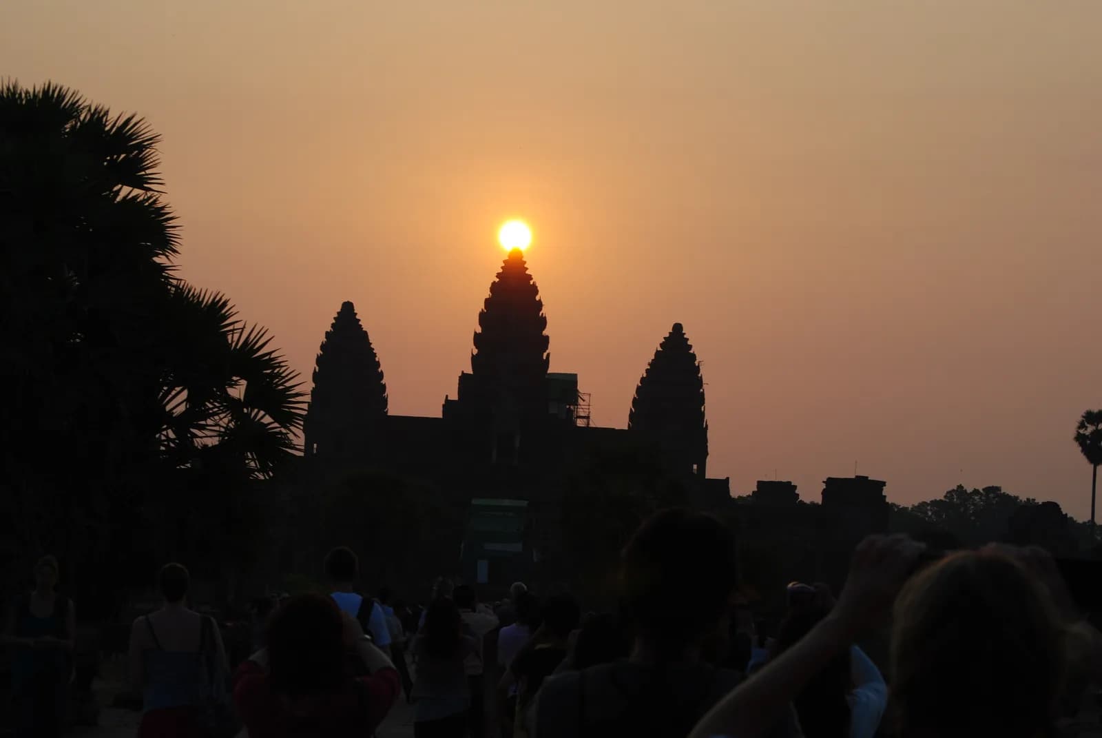
Angkor Wat sits inside a moat 200 meters wide. A causeway 352 meters long runs from the western entrance to the central galleries.
The temple stands in an archaeological park that UNESCO puts at some 400 square kilometers. The park holds scores of temples and a large system of reservoirs and canals.
The traditional view
UNESCO describes Angkor as one of the most important archaeological sites of Southeast Asia. The park holds the remains of the capitals of the Khmer Empire from the 9th to the 15th century.
Eleanor Mannikka wrote an essay on the Huntington Archive site about the role of astronomy at Angkor Wat. She says King Suryavarman II started the temple in 1113 and that all work stopped when he died around 1150.
Mannikka measured the temple and translated the lengths into the cubit unit she says the builders used. She reports that "the axes of the outer enclosing wall around Angkor Wat equal 365.24 cubits repeated 12 times." She reads that as the length of the solar year. She reads the circumference as the lunar year.
She also describes sight lines. On the morning of the spring equinox the sun rises over the central tower when seen from the western causeway. She reads these alignments as a way of tying the king to the gods. According to the Wikipedia article on Angkor Wat, her suggestions have drawn a mixture of interest and skepticism. I have not checked that in the original sources.
The surrounding city has its own story. Damian Evans and colleagues mapped a lidar survey of 370 square kilometers in 2012. They report "an entire, previously undocumented, formally planned urban landscape into which the major temples such as Angkor Wat were integrated." They find that the formal urban center covers at least 35 square kilometers. The conventional figure inside the walls of Angkor Thom was 9.
The Same Sky, Everywhere
In Earthly Enigmas I describe Angkor Wat as the largest religious monument on Earth. I put the complex at about 400 square kilometers. I note that it faces west, which I call unusual for Hindu temple architecture, and that the western causeway lines up with the sun at the spring equinox. I write that its dimensions encode the Yugas.
I also write that the ground plan of three temples replicates Orion's Belt at the scale of Giza, oriented to the sky of 10,500 BCE. I name Graham Hancock, Robert Bauval and John Grigsby as the researchers behind it. Giza and Angkor stand 4,500 miles apart and belong to very different cultures. I write that both map the same three stars onto the ground at the same epoch. I say such a coincidence challenges the limits of credulity.
I treat Angkor as one case in a larger pattern. In my closing chapters I list it beside Giza and Göbekli Tepe. I write that their astronomical alignments point to construction epochs that predate the civilizations credited with building them. I also follow the golden ratio through the Great Pyramid, the Parthenon, Angkor Wat and other sites. The articles section covers the Orion argument at Giza and the great-circle idea that includes Angkor.
I use Angkor as an example of what laser scanning has changed. I write that it was long viewed as an isolated temple complex and that LiDAR shows over 1,000 square kilometers of infrastructure. I describe it as the center of a medieval metropolis.
I end the chapter on the global network with a short list of what remains unknown. Those unknowns are who built it, how they coordinated across those distances and what happened to them.
What Nobody Has Explained
Both views lean on questions the evidence cannot yet answer. Three of them stand out.
Which sky did the builders have in mind?
Mannikka says the Khmer architect-priests were trained as astronomers and had been building temples since the sixth century. She writes that the calendrical dimensions and the alignments were "definitive elements in determining the format of the temple." In her account the sky in the plan belongs to the twelfth century and to King Suryavarman II.
In the book I read the alignments differently. I write that they point to an epoch that predates the civilization credited with building the temple.
Hancock says in a transcript of a 1999 BBC Horizon programme that the correlation "becomes as close as possible to perfect only at one date, and that is 10,500BC." His own website hosts the script. The site says the BBC removed it from the Horizon pages.
Which sky did the builders have in mind?
Which temples make the pattern?
In the book I describe an Orion plan of three temples. In the Horizon transcript Hancock describes a larger pattern. He says that if you join the dots between the temples of Angkor "you have drawn out on that map the pattern of the constellation of Draco."
Mannikka answers in the same transcript. She says "I see a vague resemblance of course because it goes up and down and off." She says the Khmer had no reference to Draco in any inscription. She explains the position of several temples by events recorded in inscriptions, and she gives a battle near 1190 as the reason for Preah Khan.
The programme's narrator says Hancock includes ten temples while the region holds more than 60. Hancock replies that the match is "by no means you know absolutely spot-on accurate, but a rather good correspondence."
Jason Colavito asks in a blog post what makes one temple a main temple and a similar one not. A comment under that post is signed John Grigsby. It says the first idea was "more a question" than a complete theory and that the writer is "no longer a fan of constellations being depicted terrestrially." I have not checked that the commenter is Grigsby.
What rule decides which temples count?
The Embankments Nobody Can Explain
Evans and colleagues report that lidar shows formal city blocks inside the moat of Angkor Wat. Each block has raised occupation mounds and ponds of consistent size. The same grid runs outside the moat on at least three sides.
They also report something no one has seen before. Beside the south moat they found "rectilinear coil-shaped embankments of indeterminate function." The team says the features are certainly contemporaneous with Angkor Wat. It found no apparent function relating to agriculture, occupation or water management. In their words "the reason for the construction of these features remains unexplained."
Evans and colleagues earlier mapped nearly 3,000 square kilometers of greater Angkor in a project that predates the lidar. They report a water management network covering more than 1,000 square kilometers. In the book I write that LiDAR shows over 1,000 square kilometers of infrastructure and that Angkor was long viewed as an isolated temple complex.
What were the coil-shaped embankments built for?
The questions I can't put down
Some questions need more room than one article gives them. Two of them keep pulling me back.
Why does it face west? In the book I call the orientation unusual for Hindu temple architecture. The Wikipedia article on Angkor Wat reports that Maurice Glaize and George Coedès proposed a funerary temple for Suryavarman II. It reports that Freeman and Jacques note other Angkor temples that depart from the eastern orientation and tie the western facing to Vishnu. I have not checked either claim in the original sources. I follow the western causeway and the equinox sunrise through Earthly Enigmas.
How accurate is accurate? Mannikka says she first became excited when she found two parallel corridors "exactly 202.14 m. in length." She asks "Why would anyone build a temple to such incredible accuracy?" In the book I follow the same kind of precision through the golden ratio and the alignments that run from site to site. You can read a free sample before you decide. The articles section has more subjects in the same format.
Sources
- UNESCO World Heritage Centre: Angkor
- Eleanor Mannikka, "The Role of Astronomy at Angkor Wat" (Huntington Archive, University of Chicago)
- Evans et al., Uncovering archaeological landscapes at Angkor using lidar, PNAS 110 (2013)
- Evans et al., A comprehensive archaeological map of the world's largest preindustrial settlement complex at Angkor, PNAS 104 (2007) (abstract only)
- BBC Horizon, Atlantis Reborn, script as posted on grahamhancock.com
- Jason Colavito, Revisiting Graham Hancock's "Draco Correlation"
- Wikipedia: Angkor Wat (secondary, for the west orientation debate and the reception of Mannikka)