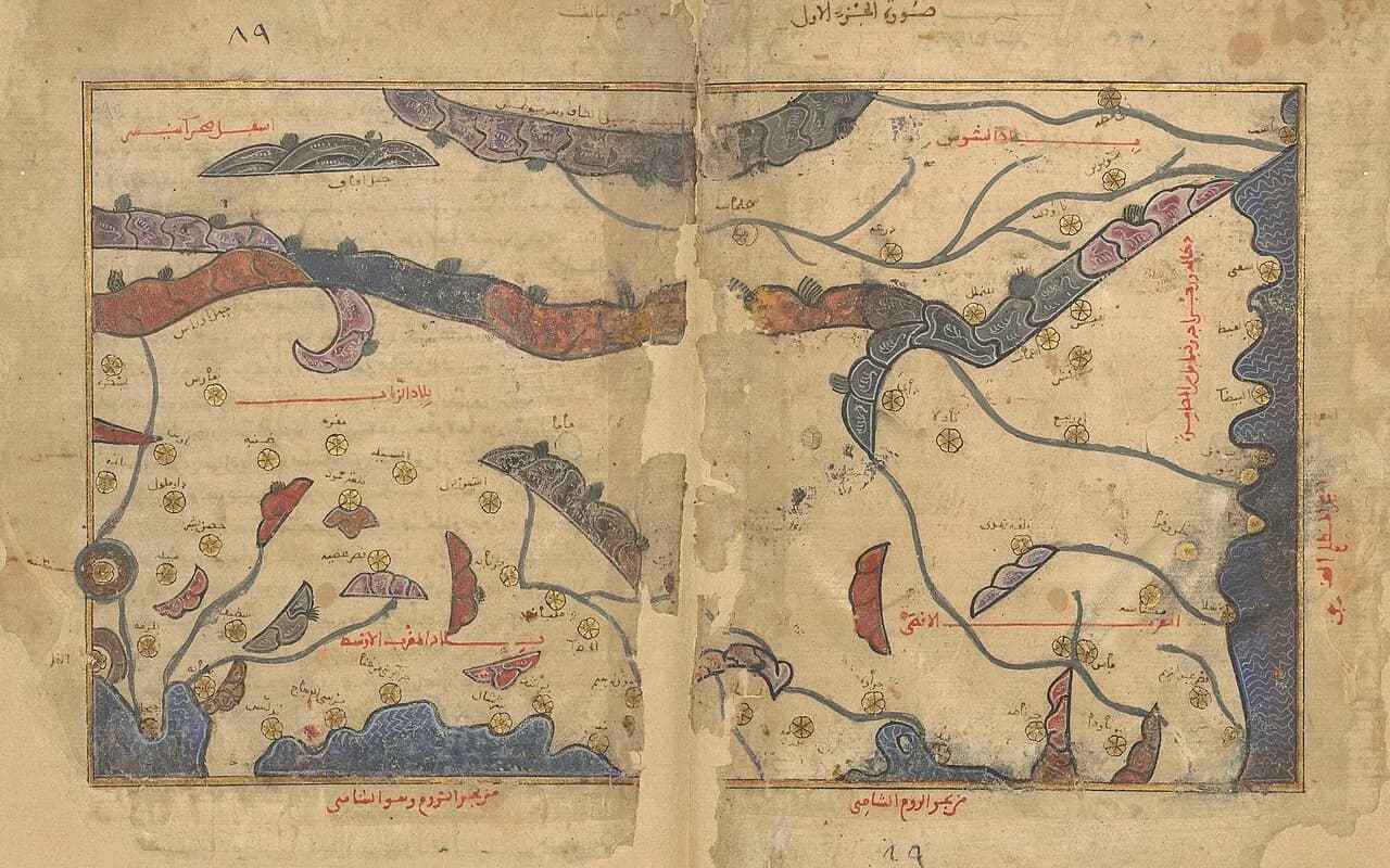
Search for al-Idrisi's world map and you get a picture with south at the top and a date of 1154. The date belongs to his book. The picture belongs to later hands.
The oldest surviving copy of that book was made about 1300. The circular map most people share comes from a copy finished in 1553.
The traditional view
Muhammad al-Idrisi worked at Palermo for Roger II, the Norman king of Sicily. S. Maqbul Ahmad writes in the History of Cartography that Roger invited him about 1138 and asked him to construct a world map and write a commentary on it.
Ahmad says the work was finished in the month of Shawwal 548, which is January 1154. The book is called the Nuzhat al-mushtaq fi'khtiraq al-afaq. Ahmad translates that as The book of pleasant journeys into faraway lands. It is also known as the Book of Roger.
The text divides the inhabited world into seven climates and gives each climate ten sections. Ahmad says each of the seventy sections of text has a sectional map, although text and map are not identical in content.
A teaching sheet from the Bibliothèque nationale de France says the work holds more than 5,000 place names, and that about half of them come from his predecessors.
On the maps the south sits at the top. The same sheet says this was probably done for religious reasons, so that the holy cities of Islam stand higher on the page (my translation). Ahmad says placing south at the top follows the Balkhi school of geographers.
The oldest of the ten surviving manuscripts is BnF Arabe 2221, dated to about 1300. Ahmad writes that none of the surviving manuscripts were contemporary with al-Idrisi.
Konrad Miller joined the seventy sections into a single map in 1928, according to Tony Campbell. That composite is the version most readers meet today, usually turned north-up.
What the Evidence Does Not Settle
In Earthly Enigmas I treat the Piri Reis map as a compilation of older source maps, and I write that a global network requires global knowledge.
The Maps That Do Not Match
Both views lean on questions the evidence cannot yet answer. Three of them stand out.
Which of these is his map?
Several objects carry his name. Al-Idrisi describes a drawing board, a silver disc and a book with seventy sectional maps. Six surviving manuscripts also open with a small circular world map.
Ahmad writes that al-Idrisi's text does not mention that circular map. He adds that "it seems that this miniature circular world map was drawn by al-Idrīsī following the larger silver map."
Emilie Savage-Smith, writing in Lost Maps of the Caliphs with Yossef Rapoport, says the circular map "does not represent al-Idrīsī's approach to cartography as displayed in his treatise." A near identical circular map sits in the Book of Curiosities, whose text dates to 1020 to 1050. That copy was made about 1200.
Savage-Smith reads the Book of Curiosities map as part of that older work. Rapoport argues it was added to the copy later. Savage-Smith writes that "at this point we simply cannot say whose interpretation is correct."
Campbell goes further. He writes that the circular map "is probably best viewed as a corrupted copy of the Charta's information and hence has no valid place in al-Idrīsī's history." He is a historian of cartography and says he is not a specialist in Islamic cartography.
The manuscripts themselves are hard to date. Campbell reports that Annie Vernay-Nouri has questioned the date on the oldest copy, because the number 700 on one folio is in a different ink from the text. I have not seen her paper.
Which of these did al-Idrisi himself draw, and which came from later hands?
How did one court gather the world?
Al-Idrisi's preface, in Ahmad's translation, says Roger "did not find a clearly formulated commentary, but only considerable disagreement." Roger then questioned travelers one by one and in groups. In the preface's words "where they agreed he accepted the information, but where they differed, he rejected it." Ahmad says this went on for about fifteen years.
The BnF sheet says a grid of questions went to every traveler passing through Palermo, including clergy, soldiers, merchants and bankers. It adds that he used the records of the Norman state.
Ahmad says the sources differ by region. For Europe and the Mediterranean he leaned on travelers and merchants in Sicily. For Asia and Africa he "depended largely upon the written Arabic sources." Ahmad adds that the sectional maps show Europe, North Africa and western Asia more accurately than the rest of Africa and Asia.
Campbell looks at the coastlines. He says the shape of Italy "could never have been obtained from any navigators' reports." He concludes that such outlines came from spoken accounts or rough sketches. He also writes that "it is hard to imagine a single other individual in that period who might have gathered more."
What was the test for a coastline that nobody at the table had seen?
What happened to the silver disc?
Al-Idrisi describes it himself. Ahmad translates the passage this way. A disc "should be produced in pure silver of a large extent and of 400 Roman ratls in weight." Ahmad calculates that as about 134 kilograms. The map engraved on it was to follow the drawing board "not differing from it at all and thus following what had been decided there without any variation."
Neither the drawing board nor the disc survives. Campbell, citing Jean-Charles Ducène, says the disc was destroyed in 1161. Ahmad notes that Miller also dates its loss to a coup in 1160 or 1161, then writes "I know of no definite evidence for this."
The shape is disputed too. Campbell says the Arabic word for the disc, da'ira, unequivocally means circular. Other passages in the same preface, he says, can only be read as a rectangular map. He writes that "scholarly opinion remains divided on this." Campbell also describes a modern re-creation by the Factum Foundation, a two-meter silver disc on which the map fills about two thirds of the surface. I have not checked Factum's own account of the disc.
What did the silver disc show, and what became of it?
The questions I can't put down
Some questions need more room than one article gives them. Two of them keep pulling me back.
What lay beyond the Atlantic? Al-Idrisi writes that "beyond this ocean of fogs it is not known what exists there." He then tells of adventurers who set out from Lisbon. The Factum Foundation quotes a translation in which they reach an island of red-skinned people. Wikipedia attributes that translation to Muhammad Hamidullah and calls it questionable. Jason Colavito gives C. Raymond Beazley's older translation, corrected against Jaubert's French. In that version eight cousins sail and an interpreter for the king questions them in Arabic. I have not checked the Arabic. In Chapter 5 I write that someone mapped the Atlantic coastlines with unusual accuracy before 1513. I follow that thread through Earthly Enigmas.
Why is the south at the top, and what is at the bottom? The BnF sheet gives a religious reason and Ahmad names a school of geographers. On the circular map Ahmad says the southern quarter is covered by "terra incognita connected with southern Africa." Campbell says the sectional maps turn the east coast of Africa sideways, which "can perhaps be best explained by a need to remain within the available space." The Piri Reis Map article asks what the land at the bottom of that chart is. You can read a free sample of the book before you decide. The articles section has more subjects in the same format.
Sources
- S. Maqbul Ahmad, Cartography of al-Sharif al-Idrisi, in The History of Cartography, vol. 2, book 1 (University of Chicago Press, 1992)
- BnF teaching sheet, La géographie dans les pays de l'Islam (al-Idrisi)
- Tony Campbell, The Charta Rogeriana: a reappraisal of the making of al-Idrisi's world map of 1154 and its dissemination
- Yossef Rapoport and Emilie Savage-Smith, Lost Maps of the Caliphs (University of Chicago Press, 2018) (text read on a third-party host)
- Factum Foundation: al-Idrisi and Roger II, Mapping the World in the 12th Century
- Bodleian Libraries: MS. Pococke 375
- Jason Colavito: Al-Idrisi's Account of the Lisbon Wanderers (secondary, for the Beazley translation)
- Wikipedia: Muhammad al-Idrisi (secondary, used only to attribute the Factum translation to Muhammad Hamidullah and to note that it is called questionable)