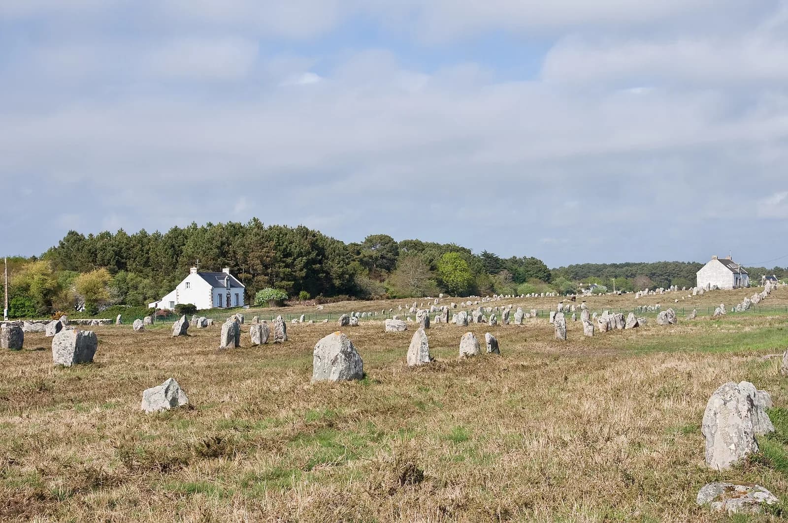
About 3,000 standing stones run in rows for roughly four kilometers northeast of the town of Carnac in Brittany. The tallest, Le Géant du Manio, stands about six meters high.
Local legend says a saint turned a pursuing Roman army into stone. The stones are far older than Rome.
The traditional view
UNESCO added the Megaliths of Carnac and of the shores of Morbihan to the World Heritage List in July 2025. It describes a dense concentration of megalithic structures built successively over more than two millennia, from about 5000 to 2300 BCE.
The Centre des monuments nationaux dates the alignments mostly between 4,800 and 3,500 BC. France Today reports a consensus that early farming communities raised the stones from local granite. It adds that they predate Stonehenge by at least 1,000 years.
UNESCO credits the builders with the technological sophistication to extract, transport and handle monumental stones. It also says the structures follow the shape of the land and were placed so that each could be seen from the others.
Stonehenge and Carnac
In Earthly Enigmas I describe Carnac as older and larger than Stonehenge. I count 3,000 to over 4,000 stones and I date the start to about 4,500 BCE. I read the rows as encoding solar and lunar positions, which takes generations of observation.
I see Carnac as the attempt to rebuild. I think the builders knew the target and were not always certain of the method. I call it a civilization in recovery.
I also write that conventional histories of Neolithic Europe do not adequately explain the organization, and that the moving of the stones has no fully confirmed account. The same long-cycle awareness shows up at Stonehenge, Carnac, Callanish and Newgrange, in seven countries not in contact by any route mainstream archaeology accepts.
The Builders Nobody Can Name
Both views lean on questions the evidence cannot yet answer. Three of them stand out.
Why are they there?
France Today quotes the Centre des monuments nationaux on the reason for the stones. They have not yet revealed it, and the centre describes them as seemingly with no links to the stars, sun or moon.
UNESCO agrees that it is not yet possible to explain with certainty the reasons for erecting these structures. It reads the layout as a symbolic view of the coastal landscape. I read it as a record of solar and lunar positions.
Alexander Thom and Archibald Thom published a paper on the uses of the alignments at Le Ménec. I have not read it.
What were the stones for?
Who raised them, and how long did it take?
The Centre des monuments nationaux says its dates run for the most part from 4,800 to 3,500 BC. It adds that it is hard to be precise within a period of more than a thousand years.
It also says nobody can tell how long the work took. A large organized group could have raised the stones in a few months or years. A much smaller group could have taken tens or even hundreds of years.
Several readings of the builders sit side by side. France Today reports early farmers. According to the Wikipedia article on the stones, Neil Oliver says in a BBC series that the alignments were erected not by Neolithic farmers but by Mesolithic hunters.
The same article reports that Pierre Petrequin and colleagues argue that three huge burial mounds nearby held "divine kings" buried with Alpine jade axeheads. Those axeheads reached from Carnac to Varna in Bulgaria. I have not checked either claim in the original.
Who raised them, and how long did it take?
What did the whole thing look like?
The Centre des monuments nationaux says the alignments as we see them today are merely the remains of more extensive prehistoric constructions. It says the appearance of the site is not what prehistoric populations knew. Many stones were removed between 1880 and 1890, and restoration campaigns have since straightened others.
UNESCO says archaeological research has confirmed that the original network included more structures. It says rising sea levels have affected some monuments and that the submerged structures remain unprotected.
France Today notes that sea levels were rising when the stones went up. It also reports one theory that the stones were an early-warning system for earthquakes.
In the book I read the imperfect precision of the rows as evidence of recovery. What did the full network look like when it was finished?
The questions I can't put down
Some questions need more room than one article gives them. Two of them keep pulling me back.
How did they move the stones? UNESCO credits the builders with the technology to extract, transport and handle monumental stones. In the book I say the moving has no fully confirmed account. The Wikipedia article quotes Barry Cunliffe as saying the Grand Menhir Brisé at nearby Locmariaquer stood 17 meters above ground and came from more than ten kilometers away. I have not checked that. I follow the question through Earthly Enigmas.
Has anyone read the code? UNESCO says the engravings form a symbolic iconographic programme that must have been executed according to a predefined code. In the book I follow the idea of a message carried forward through the stone sites. You can read a free sample before you decide. The articles section has more subjects in the same format.
Sources
- UNESCO World Heritage Centre: Megaliths of Carnac and of the shores of Morbihan
- Centre des monuments nationaux: History of the Carnac alignments
- France Today: The Menhirs of Carnac (2023)
- Wikipedia: Carnac stones (secondary, for the Oliver, Petrequin and Cunliffe points)